Import the PlanPro File
Process:
•Import the XML file
Requirements:
Description:
By importing an XML file generated in ProTop with geographical information regarding track set (in the form of GEO objects) and topology can be imported into the planning project. |
For the planning area to be processed, a PlanPro-XML needs to be requested from the customer. By importing the XML file, the geographical information regarding track set (in the form of GEO objects), topology, gradient, chainage (in the form of route points), lines and if required, other inventory objects are imported into the planning project. |
Supporting video sequence:
PlanPro-XML_importieren.mp4 (Size: 9,0 MB) (The supporting movie sequence is still valid and shows the import using the ProSig Engineer)
Procedure:
1.Execute the 'XML Import' function.
Command Line: PRS_XML_IMPORT
Ribbon: ProSig EPU -> Import/Export -> XML Import
oThe XML file is always imported into the current construction stage, therefore the required construction stage needs to be set before executing the function.
2.Select the XML file to be imported using the file selection dialog and use the 'Open' button to perform the import.
oIf the XML file is not valid, the following message is displayed. After confirming the message with 'Yes', the XML import is proceeded.

Illus.: ProSig notification regarding not valid XML file
oIf the XML file contains attributes that are required according to the PlanPro schema and for which the value 'xsd:nil="true"' is not explicitly specified, a following message is displayed. After confirming the message with 'Yes', the XML import is proceeded.

Illus.: ProSig notification about values which are not specified explicitly
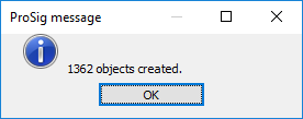
oAfter the successful import of the XML file, a message with the number of generated objects is displayed.

Illus.: ProSig message after the Import
oFor additional information, the report files of the PlanPro-XML import are stored in the ProSig Project directory.

Illus.: Report files in the ProSig Project Directory
3.If the object-data of a PlanPro project needs to be updated, it is necessary to re-import a PlanPro XML of the same project into the planning project that needs to be updated. The report files in the ProSig project directory are updated accordingly.
oThe Project metadata is not updated in the project object, when a PlanPro XML is re-imported.
oIf Geodata and also the topology of an existing PlanPro project with a defined Planning Direction are updated through a further import, the function 'Planning direction' needs to be executed again. For a description of how to update the track topology, see also Update the Topology.
